UAV Highlights of the 2023 CONEXPO-CON/AGG
Showcasing the latest developments & products in the construction, the 2023 CONEXPO-CON/AGG featured a number of innovative drone solutions for the industry.
The 2023 CONEXPO-CON/AGG recently took place in Las Vegas between March 14-18. Taking place only once every three years, the massive event brings together thousands of industry professionals, from equipment manufacturers & dealers, to contractors & distributors.
Manufacturers use CONEXPO-CON/AGG to showcase their latest heavy equipment and technological advancements for the construction industry.
While the event doesn’t focus on UAVs, many exhibitors and attendees work in sectors where drones have now become essential tools. Some of the exhibitors included Case Construction, John Deere, Caterpillar, Volvo, and Valvoline.
As part of their showcases this year, many companies exhibited a clear direction toward autonomous solutions, and greater reliance on innovative technologies like drones.
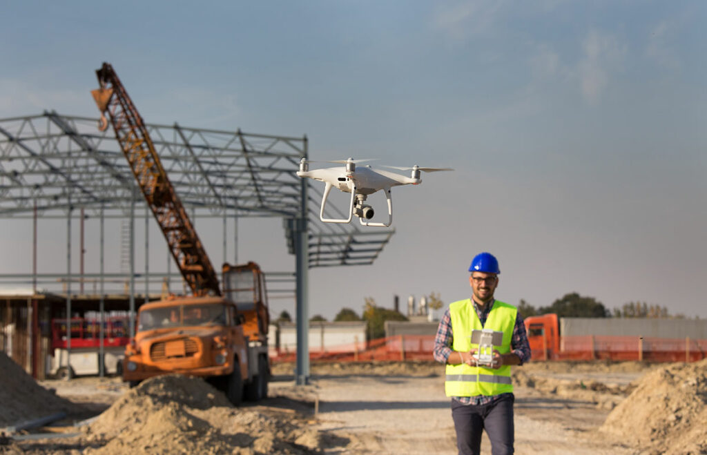
That’s because drones have become an increasingly important tool in the construction industry, providing surveyors, project managers, and contractors with a bird’s eye view of construction sites and enabling them to collect data that was previously difficult or impossible to obtain.
As a result, at the 2023 CONEXPO-CON/AGG several exhibitors displayed drones and drone-related products. The top exhibitors in the UAV space include one service-oriented company and three software/hardware providers.
Let’s take a look at what the 2023 CONEXPO-CON/AGG had to offer, and how nearly everyone in the construction business can benefit from the development of drones.
DroneUp
If you aren’t familiar with them, DroneUp is a drone services company that provides end-to-end drone solutions for businesses and government agencies. Founded in 2016, the company is headquartered in Virginia Beach, Virginia.
DroneUp offers a wide range of drone services, including aerial photography and videography, mapping and surveying, inspection and monitoring, and emergency response.
With a network of over 10,000 certified drone pilots across the United States, the company operates in various industries, including construction, real estate, insurance, and public safety.
Their presence at CONEXPO-CON/AGG signifies the importance of the industry.
With an estimated 12% of all commercial drone use in construction-related activities, DroneUp is well positioned in this space, and can help nearly everyone in the industry improve operations through faster, safer processes.
(click image to learn more)
Propeller Aero
Propeller Aero is known as the mapping software for the earthworks side of the industry.
The company’s software and hardware products specialize in drone-based data capture and analysis for the construction, mining, and quarrying industries. Founded in 2014 and headquartered in Sydney, Australia, they maintain additional offices in Denver, USA, and Manila, Philippines.
So, how can they help your construction operation?
Propeller Aero’s solution uses drones to capture high-resolution images of construction sites, which are then processed and analyzed using their cloud-based software platform. This allows construction and mining companies to manage their projects better, improve safety, and reduce costs.
In fact, Propeller Aero has been recognized for its innovative approach to drone-based data capture and analysis.
In addition to their booth, Propeller Aero also had representation at Trimble’s exhibit. The companies worked together to produce Trimble ® Stratus, a cloud-based drone survey processing, visualization, and analytics platform, integrated into the Trimble ecosystem.
It has many users excited about the product, and is quickly seeing greater adoption in the industry.
Pix4D
Pix4D is a software company that specializes in photogrammetry and drone mapping solutions. The company was founded in 2011 and is based in Lausanne, Switzerland, with additional offices in the United States and Asia.
Pix4D’s software allows users to process drone imagery and create 2D maps, 3D models, and point clouds. The company’s solutions are used in a variety of industries, including agriculture, construction, mining, and public safety.
Pix4D has received numerous awards for its innovative approach to drone mapping and analysis, and maintains partnerships with several leading drone hardware manufacturers.
And, their innovations show no signs of slowing down anytime soon; incredibly, 60% of Pix4D employees are dedicated to R&D, allowing them to adapt quickly to the market’s needs.
At this year’s CONEXPO-CON/AGG, the company showcased its Ultimate AEC Hardware Bundle.
This package includes their Pix4Dcatch and handheld RTK device viDoc, in addition to Pix4Dmatic, Pix4Dsurvey, and Pix4Dcloud Advanced. The RTK workflow merges RTK accuracy between handheld scanning and UAV data.
It’s perfect for construction projects of any size, and for every phase of the build.

(click image to learn more)
DroneDeploy
Like Pix4D, but with all data processing in-house, DroneDeploy is a software company that provides a cloud-based platform for drone mapping, data analysis, and workflow automation. The company was founded in 2013 and is based in San Francisco, California.
DroneDeploy’s platform allows users to plan, fly, and analyze drone flights, as well as share data and collaborate with team members. The company’s software is used in a variety of industries, including agriculture, construction, mining, and oil and gas.
Importantly, the software is ideal for all phases of a construction build.
In the pre-construction phase, the software allows drone pilots to produce interactive site views for clients, including maps, photos, panoramas, and videos.
During construction, pilots can help project managers by documenting the progress of a build.
Finally, upon completion of the build, additional drone flights can help create marketing materials and digital twins for historical records and maintenance management planning.
Wrapping up the 2023 CONEXPO-CON/AGG Event
CONEXPO-CON/AGG 2023 proved the strength of the industry and its commitment to innovative technologies.
In today’s fast-paced, high-pressure environment, it’s no wonder so many professionals are embracing drones.
The benefits of UAV technology are increasingly apparent, and quickly becoming too great to ignore.
With increased safety, cost savings, and improved efficiency, drones are transforming how construction projects are managed and executed.
With companies like Propeller Aero, DroneDeploy, DroneUp, and Pix4D leading the charge, it’s clear that the future of construction is in the skies.
As drone technology continues to evolve and become more autonomous, it’s exciting to think about the endless possibilities that lie ahead for UAVs in the construction industry.
—
So, are you ready to take advantage of drones for your organization? If so, how do you get started? Do you hire out or bring your drone program in-house?
At Consortiq, we help you find a better way with drones, from consultation and program implementation to actually doing the work for you.
Ready to learn more? Just complete the form below to schedule a risk-free consultation!

David Daly - Contributing Author
David Daly, is an award-winning photographer/writer and licensed (FAA) Commercial sUAS pilot. A graduate of the United States Naval Academy, David is a former Marine Corps officer with a BS in Oceanography and has earned his MBA from the University of Redlands. David has worked for Fortune 100 companies and has a background in aerospace, construction, military/defense, real estate, and technology.
Ready to Utilize Drones For Your Organization?
Contact Us Today to Get Started!