GIS and Drones: the Perfect Match
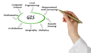
Geographic Information Systems simplify data analysis for industries everywhere. Combined with drones, it becomes even more powerful. If there’s one thing we have plenty of,

Geographic Information Systems simplify data analysis for industries everywhere. Combined with drones, it becomes even more powerful. If there’s one thing we have plenty of,

No matter where you are in the world, you’ve probably felt the economic pain of the growing cost of oil and gas. As demand continues

Drones are simplifying and streamlining land reclamation projects everywhere. From real-time data to safety improvements, UAS have become indispensable tools. Land is a precious commodity.


Airport House,
Purley Way,
Croydon,
Surrey
CR0 0XZ
169 Madison Avenue, Suite 11988
New York, NY 10016-5101
© Copyright 2012-2025 | All rights reserved | Privacy Policy