Key Ways Dredging Operations Benefit from Drones
They can be massive, expensive undertakings. Fortunately, drones can help dredging operations in numerous ways.
My first foray in to the halls of academia (at least at the collegiate level) was when I was a midshipman at the United States Naval Academy. While the four years I spent there were extremely challenging, I was always amazed at how beautiful the campus was.
Situated in Maryland on the banks of the Chesapeake Bay, the campus seems to occupy both the land and water simultaneously.
I was surprised to learn that much of the shoreline and buildings were actually built over land reclaimed from the bay. Thanks to the engineering marvel that is dredging, the school’s library, sports fields, and more came into existence.
Dredging has been used since ancient times with some of the earliest examples seen in ancient Egypt. If you are unfamiliar with dredging, it is a process where sediment or debris is removed from the bottom of bodies of water, such as lakes, rivers, harbors, and even the ocean.
Dredging can be used to keep water ways navigable and to create new land just like it was done at the Naval Academy, as well as places like Dubai’s famous Palm Jumeirah in the UAE.
However, dredging is often an expensive and time-consuming process.
As with many industries, drones can assist in optimizing dredging operations for those conducting dredging and those paying for it. Drones are capable of assisting in numerous ways. If you’re involved in the dredging industry or paying for dredging services, adding drones into your operations can significantly affect your bottom line.
Drones In Dredging Operations
There are numerous ways drone technology can assist dredging operations.
With dredging price tags often in the millions of dollars, anything positively affecting the bottom line is worth considering. Two of the most useful applications for UAVs for those conducting dredging operations are surveys & mapping and equipment inspections.
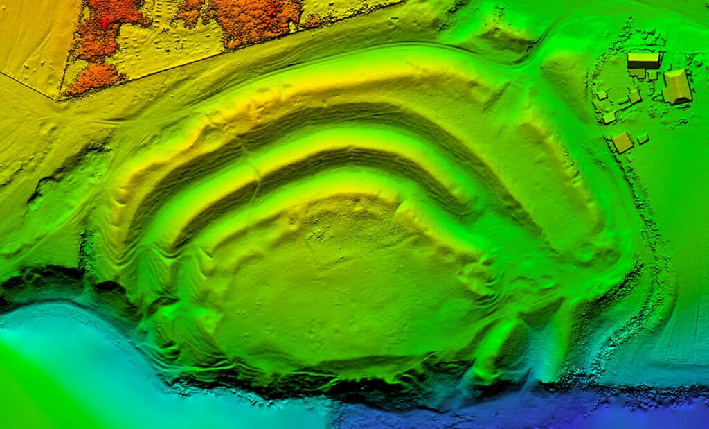
Many dredging operations occur in coastal areas. Before dredging operations can begin, a solid understanding of where the land and water meet is required. Drones can hover over a coastline and use RGB cameras or LiDAR to make detailed 2D and 3D maps for the planning phases of dredging operations.
In addition to aerial views of the shoreline, dredging operations need information on the land underneath the water. Bathymetric surveys once required ships with side scan sonar or towed sonar instruments.
However, ships are far more expensive than drones. Using an echosounder on a tethered cable, drones can map the topography of land underwater and create accurate maps at a fraction of the costs associated with traditional methods.
While maps above and below the water are incredibly beneficial, drones are not limited to this function alone.
For instance, dredging operations use expensive equipment that is difficult to maintain. However, drones can easily inspect these machines for preventive maintenance.
Further, if a major failure of a barge, crane, or scooper occurs, UAVs can become one of the most responsive assets to conduct initial inspections. If the failure poses a safety concern for people, drones can also remove the human element from harm’s way while still gathering crucial data on the situation.
For Those Paying for Dredging Services
Many operations require dredging services.
And, when that’s the case, a common practice is to pay for services based on the volume of sediment removed from an area.
However, in many cases, the company paying for the services has no way to verify the amount of removed sediment. While I’m sure most companies bill appropriately and without inflating numbers, having a means to validate these numbers can increase your confidence tremendously.
Just like in the mining and quarrying sectors, drones remain excellent tools for producing volumetric calculations. In fact, UAV technology has been shown to be incredibly accurate at this task.
Drones can fly over barges or land where sediment is being dumped and quickly determine the volume of dredged materials. With accurate calculations from drone-based survey, all parties involved can be confident on the amount of displaced materials.
Key Takeaways
Also dredging can be an expensive process, the payoff can be equally significant. From keeping waterways navigable to creating new land masses, dredging has benefited society since ancient times.
Although drones remain a relatively recent addition to the dredging industry, they’re already making a positive impact.
Whether you’re looking for faster & less expensive surveys, speedy inspections & disaster response, or a means to validate the services you pay for, drones can assist in a number of ways.
Moving forward, greater adoption of UAV technology in this sector will continue providing advantages to service providers and end users.
—
So, are you ready to take advantage of drones for your organization? If so, how do you get started? Do you hire out or bring your drone program in-house?
At Consortiq, we help you find a better way with drones, from consultation and program implementation to actually doing the work for you.
Ready to learn more? Just complete the form below to schedule a risk-free consultation!

David Daly - Contributing Author
David Daly, is an award-winning photographer/writer and licensed (FAA) Commercial sUAS pilot. A graduate of the United States Naval Academy, David is a former Marine Corps officer with a BS in Oceanography and has earned his MBA from the University of Redlands. David has worked for Fortune 100 companies and has a background in aerospace, construction, military/defense, real estate, and technology.
Ready to Utilize Drones For Your Organization?
Contact Us Today to Get Started!


