Understanding Drone Capabilities, Designs, Sensors, and Uses
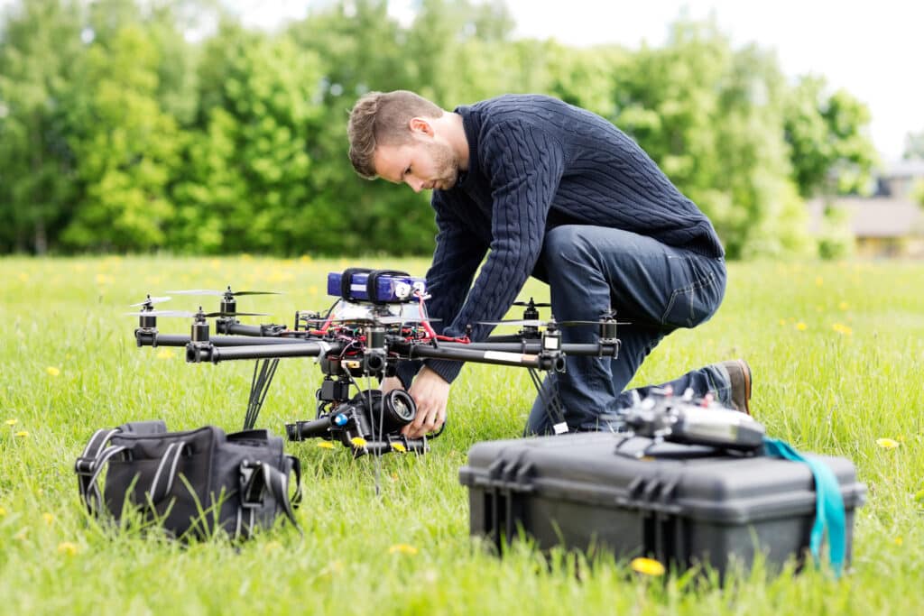
Professional drone pilots know their equipment inside and out. They understand their camera’s specifications, the aircraft’s range capabilities, and how well obstacle avoidance sensors work. For professionals, understanding specific drone capabilities is vital.
Of course, if you’re not a commercial drone pilot, many of the technical aspects of drones aren’t critical for you to understand. However, it’s still beneficial to know a little about UAV options on the market.
The main benefit of understanding drone capabilities and limitations is knowing how to employ them properly. Like all tools, drones provide maximum benefits when used as intended.
Now, if you’re sub-contracting out your drone needs, your pilot should already have the right tool for the job. You won’t necessarily need to worry about the details here.
But, with that said, knowing what options are available will help guide your quest for the right pilot. You wouldn’t necessarily hire a real-estate photographer when you need a complete building scan, and you wouldn’t hire someone with a large, fixed-wing craft to conduct a brief thermal inspection.
After all, like the old saying goes, “to the man with a hammer, every problem is a nail.” If your contractor only has a small quad copter, they won’t recommend a fixed-wing drone for the job, since they don’t have the capability. But, more on that later.
Let’s break down our discussion into three parts. We’ll start with the aircraft, then discuss some payloads options, and wrap up with some use case considerations for pairing drones and payloads.
The Aircraft: Fixed-Wing, Rotary, or Hybrid?
Drones come in many configurations. They can be fixed-wing, rotary, or a hybrid.
Rotary drones, like common quadcopters, can take off vertically and are ideal for maneuverability and hovering situations.
Now, although many drones are quadcopters (having four propellers), others can have many more. For instance, octocopters, as their prefix ‘octo’ implies, come equipped with eight propellers. These tend to be larger and more expensive, of course, but also capable of carrying larger, more advanced payloads.
Then there are fixed-wing UAVs, with some unique drone capabilities of their own.
In general, fixed-wing drones require some form of runway to take off & land, much like an airplane. Though this might limit the areas they can safely launch and land, the key trade-off is that they’re designed to be faster and more efficient. The drone capabilities of these machines make them ideally suited for long-distance flights or surveying large areas.
Then, there are hybrid drones. These drones utilize Vertical Take-Off and Landing (VTOL) technology to raise to the desired height and then perform in the way a fixed-winged drone would. In this way, they make use of the best aspects of both rotary and fixed-wing craft.
Drone Capabilities Vary by Power Source
Drones utilize a variety of power sources, though most commercial drones use LiPo batteries. But, there are many other power sources, including gas, hydrogen, and even solar.
There are pros and cons to each type of energy source, making some ideal for specific use cases, but not for others. While drone capabilities like flight time and payload capacity might be greater in gas-powered UAVs as compared to LiPo batteries, they’re typically less convenient, louder, and limited to larger drones.
Solar-powered drones, on the other hand, are typically designed and well-suited for endurance missions, like mapping or surveying large tracts of land. The solar-powered SolarXOne, for instance, is well suited for such tasks, with the capability of 12-hours of continuous flight.
Others, like the Zephyr, are even larger with even greater endurance, capable of reaching 70,000 ft, and remaining aloft for months at a time. The Zephyr not only offers tremendous potential for large-scale surveillance, it can also be used as a connectivity center, functioning as a replacement for cell-towers in remote areas.
As impressive as these solar-powered drone capabilities are, however, they’re not your best choice for brief operations or inspecting smaller areas.
Different Hardware and Software Provide Different Drone Capabilities
Within the design of a given UAV is a collection of hardware and software that allow the drone to fly and maneuver as desired. Laser range-finders, accelerometers, obstacle avoidance sensors, computer code, and AI algorithms make the aircraft a useful tool.
The drone will also have a remote or some other type of ground control station. This remote transmits the radio signals that turn the pilot’s instructions into actions the drone performs.

Drone Payloads: RGB & Thermal Imaging Systems
When most people think of drone payloads, they typically think of standard photography (RGB) cameras.
These cameras take traditional pictures and require light, just like the human eye. While the data these cameras gather is very useful (roof inspections, aerial surveys, viewing crop damage, etc.), it’s only one of many different payload options for UAVs.
For instance, thermal optics are a popular UAV payload.
Using infra-red (IR) sensors, thermal cameras collect data on temperature and temperature variations. However, not all thermal cameras are created equally. Knowing the minimum resolution needed when using this payload is essential, since various cameras are more sensitive than others.
It also helps to know the difference between radiometric and photometric thermal cameras. In general, radiometric-capable cameras are usually only available on higher-end systems. It captures more detailed data, but isn’t always necessary.
If you only need to know if something is hotter than it’s surrounding area, but don’t need to know exactly what temperature it is, then photometric-capable cameras are probably all you need.
For instance, picture if you were inspecting a series of exhaust fans or air conditioning units on a commercial building. If one is significantly hotter or colder than others, you probably don’t need to know exact temperature. It’s different than the rest, and so requires further, manual inspection.
However, if you had an application in which exact temperature information needed to be known, then you would need the further information radiometric data provides.
Gas Leak Detectors, LiDAR, and More
Performing work in oil & gas industry? If so, drones equipped with gas leak detectors are one of the most effective tools in your arsenal.
In the past, traditional methods of detecting methane leaks meant two unattractive options. First, was walking a route on foot, with hand-held methane detectors. However, this severely limits the amount of ground you can cover. And then there’s the terrain itself. Often, gas pipelines run through challenging terrain at best, and dangerous at worst.
The second option then, was to use a helicopter equipped with a methane detector. Although these can cover plenty of ground, they’re incredibly expensive – and dangerous. Not only that, but they’re not nearly as effective as drones.
Drones not only cover plenty of area in a hurry, they’re also much more effective at detecting methane leaks. For safety reasons, helicopters must fly much higher than drones, and often do so at higher speeds. This means drones can get closer, leading to far more accurate results.
Mapping applications benefit significantly from Light Detection and Ranging (LiDAR) payloads. LiDAR uses pulses of laser light to measure the distance between the sensor and other objects. The measurements are collected and used to create a point cloud.
LiDAR can help generate incredibly accurate 3D models or 2D maps, and can ‘see through’ foliage and vegetation. This is essential in pre-construction site assessments.
There are many other sensors drones can carry, laser-range finders, radiation monitoring equipment, and even specialized equipment, like defibrillators and life preservers.
Consortiq’s Wyatt Filipowicz explains the benefits of drones for detecting gas leaks
Specific Use Case Examples
Every operation is different, and requires different drone capabilities and sensors for the job.
For example, if you’re working in precision agriculture inspecting very large farms, your ideal pairing is probably a fixed-winged drone with a multispectral camera. For example, the eBee X, created by SenseFly, is perfectly designed for these operations.
This type of drone can travel long distances in straight lines, making it well suited for surveying fields and orchards. The multispectral camera can detect field characteristics such as plant count, water usage, the presence of disease, and soil nitrogen levels.
Pretty impressive, right?
For industrial inspections, you will likely need RGB and thermal cameras.
Rotary UAVs like quadcopters are perfect for this use case. They combine the maneuverability required to move around structures with potent payloads. Thermal cameras can provide a record of spot temperatures, which help in diagnosing problems and conducting preventative maintenance.
Or, maybe you’re in one of the many industries that benefit from drone mapping.
Highly accurate maps in both 2D and 3D can be created using a rotary drone, RGB camera, and LiDAR.
Of course, for survey-level accuracy, you’ll need some specialized accessories. However, the combination of drones and LiDAR have been used to make digital twins of cities, preserve cultural heritage, and even reveal Mayan pyramids hidden under hundreds of years of jungle growth.
The Important Takeaways
Of course, there are countless uses for drones, and dozens of combinations of UAVs, sensors, and equipment.
While you don’t need to be an expert at UAVs as a non-pilot, it helps to know a little about drone capabilities and limitations. Understanding even the basics makes you that much more prepared to capitalize on the advantages that come with drone technology.
Whether fixed-wing, rotary, or a hybrid, there’s a drone available for any job you need. And, with an incredible assortment of sensors, cameras, and imaging systems, there’s no data you can’t acquire.
Fortunately, you never need to go it alone. You can always reach out to friendly, experienced experts in the field.
At Consortiq, we help you find a better way through drones and technology. Whether you’re a pilot looking for training, a business interested in developing a drone program of your own, or simply looking to hire someone to do the work for you, we have a solution that fits your needs.
Just fill out the form below, and we’ll be happy to discuss any questions or concerns you may have!
Are you ready to find your better way?

David Daly - Contributing Author
David Daly, is an award-winning photographer/writer and licensed (FAA) Commercial sUAS pilot. A graduate of the United States Naval Academy, David is a former Marine Corps officer with a BS in Oceanography and has earned his MBA from the University of Redlands.
David has worked for Fortune 100 companies and has a background in aerospace, construction, military/defense, real estate, and technology.