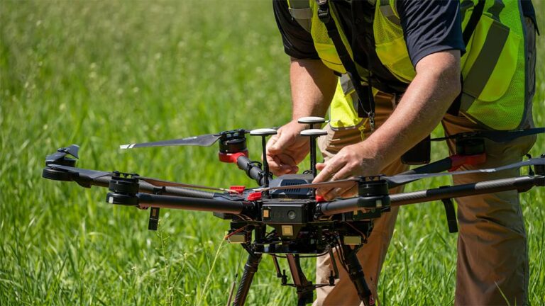
How Drones Are Growing the Agricultural Industry with Soil Analysis
Earth’s population stands at nearly 8 billion people, a number that continues to rapidly grow.
Without advancements in precision agriculture, it’d be impossible to sufficiently feed that many people.
The demand for food continues to swell, as the days of traditional farming methods are long gone. Even small family-run operations must rely on science and technology to improve efficiency and lower costs.
That’s where drones come into play, as they’ve had an incredibly positive impact on the agriculture industry.
In 2020, for example, during one of the most harsh summers to date, Australian farmers yielded an 11 percent winter crop yield increase by using drones.
When compared to traditional methods, drones are usually less expensive, faster, and more accurate.
Let’s break down one of the best use cases in agriculture: soil analysis.
Why does soil analysis matter?
Without healthy soil, farming cannot be successful – regardless of the climate.
Soil is the medium for both water delivery and the collection of vital nutrients required by all crops to thrive. Agronomists have long touted the benefits gained from soil analysis, and science backs them up.
Traditionally, this requires dirt samples to be physically collected and sent to a lab, where the analysis takes place.
After samples are collected and studied, reports are generated detailing the levels of nitrates, potassium, phosphates, soil pH, and organic matter content present.
With this data in hand, farmers have the information they need to adjust nutrient levels with the right fertilizers and soil conditioners.
Manual analysis v. drones
For manual soil analysis, farmers or third parties collect samples of soil from a given location.
A typical sampling size might be something like one soil sample per acre of land. Once all the samples are collected, they are brought to a laboratory and tested.
Farmers are then provided a report that details the results of the testing. However, depending on the workload of the lab, this takes days or sometimes weeks.
With farms spanning hundreds or even thousands of acres, farmers – or even an outside observer – can see how a process can quickly escalate into a lengthy and expensive undertaking.
If you find yourself saying, “there’s got to be a better way,” you’d be correct. And, thankfully, there is.
In a simple flyover, drones conduct soil analysis in real-time using multispectral cameras. The data they provide can be acted on immediately and offers information for the entire area scanned – not just representative samples.

Technology at work: More than meets the eye
So how does it all work, and what can it provide to any agricultural operation?
Multispectral cameras were initially invented for targeting systems in military operations.
Traditional cameras capture light in the red, green, and blue wavelengths. These wavelengths of light are the same ones visible to the human eye, and how we typically see the world around us.
However, this limited spectrum is not the only form of light that can be seen – with the right tools at least. Multispectral cameras use specialized filters, capturing light in wavelengths we cannot see, such as near-infrared, infrared, and ultraviolet light.
Looking at the same images through different light filters produces more information.
You may have experienced this first-hand without even realizing it. If you have ever tried on a pair of yellow-tinted sunglasses, you’ve probably noticed a sharper feel to objects than with the naked eye alone.
Properly equipped, drone cameras work in a similar fashion.
As the drone flies over a location, the camera captures images in various wavelengths simultaneously. The data collected is then calibrated for environmental conditions, such as sunlight, and compared to baseline numbers.
Software takes the images collected by the drone and turns them into actionable data.
Because of the cost effectiveness and speed efficiency, farms of all sizes benefit from this technology. Whether an agricultural operation is ten acres or 10,000 acres, large sections of fields can be covered quickly.
Even older drone technology can cover hundreds of acres in under an hour.
The Takeaways
As the pressure to feed a hungry world continues to grow, drones are becoming indispensable tools for farmers across the world.
No longer is there a need for tedious manual soil sampling. With a properly equipped drone, you simply fly, capture and process images, and see detailed information on your soil’s makeup – all without ever taking a single physical sample.
Farmers save time, get an accurate picture of every inch of ground, and most importantly, spend less money than conducting manual soil analysis.
But the benefits to the agricultural industry don’t end there. In addition to soil analysis, drones can determine plant count, detect disease, assist in planning irrigation strategies, and help with pesticide spraying.
This list continues to grow as the UAV industry introduces more new advancements.
Global conditions make farming difficult. Water shortages and a changing climates eat away at profits. To survive, farmers must make their operations and efficient as possible.
Drones offer farmers a cost-effective platform to remain competitive in a chaotic world.
So, how will you harness the benefits of drones?
At Consortiq, we help you find a better way with drones, from consultation and program implementation to actually doing the work for you.
Ready to learn more? Just complete the form below to schedule a risk-free consultation!

David Daly - Contributing Author
David Daly, is an award-winning photographer/writer and licensed (FAA) Commercial sUAS pilot. A graduate of the United States Naval Academy, David is a former Marine Corps officer with a BS in Oceanography and has earned his MBA from the University of Redlands. David has worked for Fortune 100 companies and has a background in aerospace, construction, military/defense, real estate, and technology.
