Simplifying Land Reclamation Projects with Drones
Drones are simplifying and streamlining land reclamation projects everywhere. From real-time data to safety improvements, UAS have become indispensable tools.
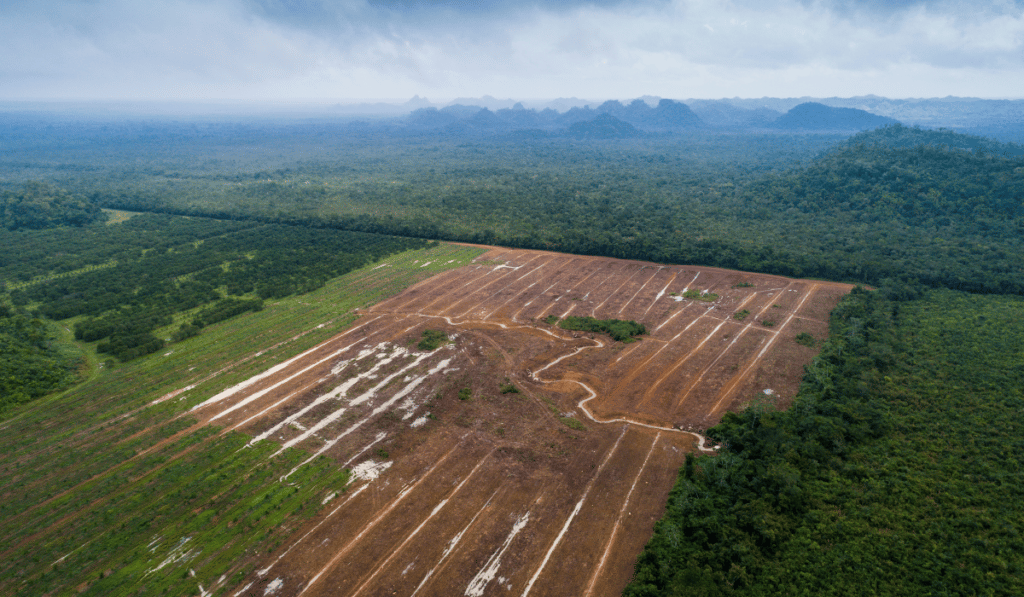
Land is a precious commodity. As the world’s population grows, usable land continues to disappear at a rapid rate. Some locations, particularly small islands with high population densities, are desperately in need of acquiring more room.
Several countries have made substantial gains in land through reclamation efforts. By far, the country with the most significant land reclamation growth has been China. To date, the government has created over 4,600 square miles of land.
When looking for more land, there are few viable options. One of the few acceptable methods is land reclamation.
This process takes land or water otherwise unusable for a specific purpose and transforms it into land people can use.
One of the best examples of such a project is the artificial Palm Jumeirah island, off the coast of Dubai, in the United Arab Emirates. (Side note, the steak at Atlantis Dubai on the Palm Jumeirah is amazing!)
Land can be reclaimed from the ocean, wetlands, lakes, and from contained land through remediation efforts. While creating more useable land can be highly beneficial, the process is costly. The Palm Jumeirah island, for example, was built at a staggering cost of $12 billion.
Drone technology is an excellent tool that land reclamation experts should utilize as much as possible. Offering greater efficiencies, lower costs, and better data quality, UAVs are indispensable in many land reclamation use cases.
Three such cases are aerial surveys, remediation testing, and project management.
Aerial Surveys Outperform Manual Methods
Aerial surveys and mapping are well-known, proven applications for drones.
And, it comes as no surprise that land reclamation efforts have a tremendous need for mapping, surveying, and planning.
In fact, getting an accurate representation of the land is essential in land reclamation operations. Often, it’s one of the very first steps in the process.
Before the ground can be recontoured, drained, or dredging operations commence, accurate maps are created.
Drones can create accurate maps much faster than manual techniques, even when the subject area is of significant size. Most regions targeted for reclamation operations are sometimes hundreds or thousands of acres in size.
With areas this large, traditional mapping methods would take days or weeks to cover.
Drones cover the same location as manual survey teams in a fraction of the time.
“But,” you might be wondering, “are they really accurate enough to rely on?”
That’s a normal question, and an important one. Fortunately, we have some good news.
Within the last few years, drone-based surveys have proven to be as accurate as manual techniques. With the right equipment, UAVs reach centimeter-level accuracy in less time, and at a fraction of the cost traditional methods require.
When you add in the ease of access drones have to remote and dangerous areas, using another technique seems questionable.
Click image for more information on how.
Remediation Testing for Land Reclamation Projects
Only some land reclamation involves turning wetlands or the ocean into land.
Sometimes, the major issue preventing the use of land is contamination. For instance, the United Kingdom estimates there are 20,000 hectares of contaminated land within the country.
Although the scope of contaminated land in the United States is unknown as far as exact data, one can imagine the vast, possible extent.
Abandoned mines, crumbling, abandoned industrial sites, and even former military bases & facilities, all house potential problems.
The Environmental Protection Agency (EPA) notes that no single source for tracking contaminated land exists. However, the EPA does monitor sites of concern, overseeing anywhere from 640,000 to 1,319,100 facilities to prevent releases of toxins into communities.
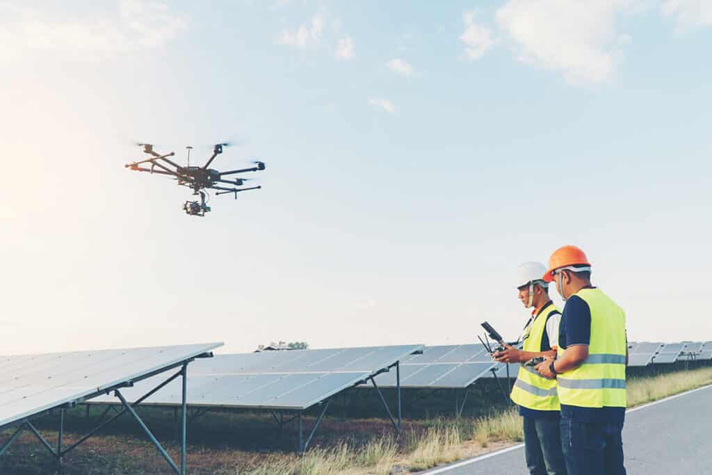
When looking to reclaim contaminated land, one of the first steps is understanding the level of toxins in the environment. Drones are an excellent asset for accomplishing this task. As a minimally invasive tool, drones can fly over sites to collect a wide range of valuable data.
Drones carrying multispectral cameras can easily record information on soil composition and the presence of certain toxins, such as arsenic.
Yet, drones aren’t limited to only land use. UAVs can also collect information on water pollution. Commercial drones are now available for safely collecting water samples for testing, even in remote areas.
Testing these environments with a more efficient platform than traditional methods is a huge advantage.
It’s significantly faster, and offers an ease of access & safety unheard of through conventional means.
Drones Assist Project Management
The complexity of land reclamation operations cannot be overstated.
The planning and execution of these efforts often requires a small army of professionals. Keeping all the pieces moving is a challenging task.
Additionally, costs rise when projects fall behind, and contractual penalties may be incurred.
And, when it’s your job on the line, that’s something you simply can’t afford to risk.
In several ways, land reclamation projects follow many of the same project management workflows as construction developments.
Keeping construction and reclamation projects on time and within their planned budgets requires an accurate understanding of where the project is at any given time.
Drones can fly over projects whenever the project manager needs them to for a real-time assessment of the situation. The data collected can determine if projects are on track, calculate stockpile levels, monitor heavy equipment, and more.
Using the data collected by UAVs, a project manager can make the necessary changes on the ground to avoid delays and other costly mistakes.
A Growing Demand
The use of UAVs for land reclamation projects is likely to increase in the next few years.
As population pressures increase, the need more more useable land becomes greater. And, in cases of land reclamation for cleaning up contaminated areas, it’s going to be a tough ask.
The benefits of drone technology are too good to pass up.
From speeding up surveys, to keeping your team safe and your company under budget, UAVs offer perks few other systems can match.
So, are you ready to take advantage of drones for your organization? If so, how do you get started? Do you hire out or bring your drone program in-house?
At Consortiq, we help you find a better way with drones, from consultation and program implementation to actually doing the work for you.
Ready to learn more? Just complete the form below to schedule a risk-free consultation!

David Daly - Contributing Author
David Daly, is an award-winning photographer/writer and licensed (FAA) Commercial sUAS pilot. A graduate of the United States Naval Academy, David is a former Marine Corps officer with a BS in Oceanography and has earned his MBA from the University of Redlands. David has worked for Fortune 100 companies and has a background in aerospace, construction, military/defense, real estate, and technology.
Ready to Utilize Drones For Your Organization?
Contact Us Today to Get Started!